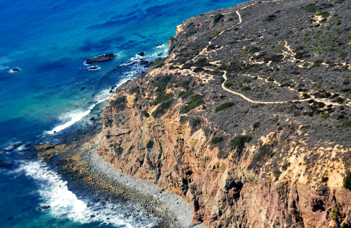
Dana Point Headlands trails and entrances
The Dana Point Headlands have a trail network of about three miles, or 4.8 km, connecting conservation parks, viewpoints, coastal approaches and the Nature Interpretive Center. This is a network to select from, rather than a promise that every section is open whenever you arrive. Choose your entrance and the part you want to walk before setting out.
Access is available from Green Lantern or Dana Strand Road at the end of Selva Road. Parking there and at the Interpretive Center is limited. Keep the walking plan flexible enough to use an appropriate entrance without relying on a space beside a particular path. For the wider setting, read the Dana Point overview and use the arrival guide to separate the journey into town from the final approach to the trails.

Preserve Trail access in winter
The Dana Point Preserve Trail has restricted access days in the city's winter notice dated 8 September 2026: Tuesday, Thursday, Saturday and Sunday. The winter notice dated 8 September 2026 gives opening hours of 08:00 to 16:00 and no season-end date. Check the current access notice before travelling. The notice lists Monday, Wednesday and Friday as closed. Choose a permitted day and follow the current opening and closing information at the entrance when deciding how much of the walk to attempt.
The winter notice gives no season-end date, so avoid building a later visit around an assumed switch to a summer timetable. Keep the Preserve schedule separate from the other parks and paths in the Headlands area. A coastal walk can involve several managed spaces, and one section's access arrangements should not become the rule you apply to every viewpoint.
Make the restricted section the planning anchor if it is important to your visit. Then decide whether to add a beach approach or another coastal stop. The beaches guide explains why the return climb and the equipment you carry matter, especially when combining a walk above the coast with time down on the sand.
Headlands hike
Our take: This guided hike combines the Headlands trails with coastal ecology and the interpretive center.
Hand-picked tours, booked through GetYourGuide. Prices are indicative starting prices in US dollars (as of November 2026). Tap a tour for live availability and the current price in your currency.

Walk the coast with an ecology guide
The two-hour coastal walk combines Headlands trails, the Interpretive Center and beach ecology. The family-oriented activity is described for children aged five and over.
A guided coastal hike and ecology walk
The guided Dana Point coastal hike lasts two hours and meets at 34001 Dana Strand Road. Its focus includes walking up and down to the Headlands trails, exploring the Interpretive Center, beach ecology and coastal geology. The activity describes an adaptable pace and is intended for families and children aged five and over.
Choose the guided walk when explanations of the coast matter as much as the view. Seasonal wildlife spotting and looking at what washes onto the shore are part of its approach, while encounters depend on what is present. A booking follows the same access rules as other visits, including any restrictions affecting the protected paths. Use the excursions overview if you would rather compare a walking activity with another way to explore the coast.
Interpretive Center and coastal ecology
The Dana Point Nature Interpretive Center is part of the Headlands trail setting and a focus of the guided ecology walk. The combination of paths, shoreline observation and explanations helps connect the landscape above the sea with the coastal processes below it. Decide whether you want that structured interpretation or a self-directed visit based mainly on walking and viewpoints.
Headlands conservation also concerns sensitive habitat, including the Pacific pocket mouse. Stay on permitted routes and treat boundaries as part of the visit rather than an obstacle to a photograph. Pets are not allowed on the Headlands Conservation Area trails. Keep that rule in mind before bringing a dog along for a day that also includes other parts of town.
Viewpoints, rain and protection rules
Dana Point Headlands viewpoints are reached as part of the coastal network, with access depending on the path chosen and its current condition. Do not let a desired view determine a route through a closed area. Leave enough time to return along permitted paths rather than counting on a shortcut at the end of your walk.
After substantial rain, the city allows for trail closures of up to 72 hours and reopening when conditions are sufficiently dry. Follow notices for the particular day; the rain rule itself is not an announcement that a closure is in force. Shore access also needs a separate assessment of surf and wet conditions. If combining Dana Point hiking with time on the water, keep the paddling plan flexible rather than assuming both activities will suit the same weather.
Questions about the Headlands
How long is the Headlands trail network?
About three miles, or 4.8 km, is the length of the Dana Point Headlands network linking parks, viewpoints, coastal approaches and the Interpretive Center. Choose a section according to access and conditions. The network figure is not the distance of a single compulsory walk or a promise that every path is open.
Which days does the winter Preserve notice allow?
Tuesday, Thursday, Saturday and Sunday are the access days in the Dana Point Preserve Trail winter notice dated 8 September 2026. The winter notice dated 8 September 2026 gives opening hours of 08:00 to 16:00 and no season-end date. Check the current access notice before travelling. Monday, Wednesday and Friday are listed as closed. Follow the current entrance notice for hours, and keep these restrictions separate from the arrangements for other parks in the Headlands area.
Who is the guided ecology walk for?
The Dana Point guided ecology walk is described for families and children aged five and over. The two-hour activity includes an adaptable pace, Headlands trails, the Interpretive Center, beach ecology and coastal geology. Choose it for an explained coastal walk while allowing for the same protected-area access rules that apply to other visitors.